Want to export your AutoCAD DWG drawing as a KML or KMZ file and overlay it on Google Earth? Whether you're working on site planning, infrastructure mapping, or geospatial analysis, this tutorial shows you exactly how - using Automapki Application, a dedicated CAD-to-GIS export tool for AutoCAD, BricsCAD, GstarCAD, and ZWCAD.
No manual coordinate conversion. No third-party GIS software. Just a clean, georeferenced overlay directly in Google Earth.
How to Export AutoCAD DWG to KML for Google Earth: Step-by-Step
📥 Download Automapki Application
Download the free evaluation version of Automapki Application, compatible with:
- AutoCAD - Autodesk's industry-standard CAD platform
- BricsCAD - a DWG-native AutoCAD alternative
- GstarCAD - cost-effective professional CAD software
- ZWCAD - lightweight DWG-compatible CAD platform
Install it as an add-on inside your existing CAD application - no standalone app required.
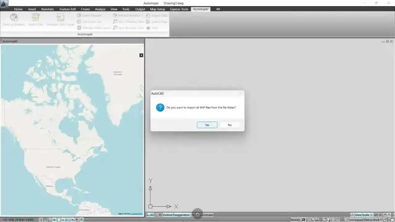
🚀 Run the Map Export Command
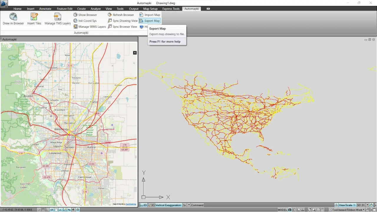
Open your DWG file in AutoCAD (or your compatible CAD platform). Type AmExportMap in the command window, or click Export Map from the Automapki application menu to launch the export dialog.
🌎 Set the Coordinate Reference System
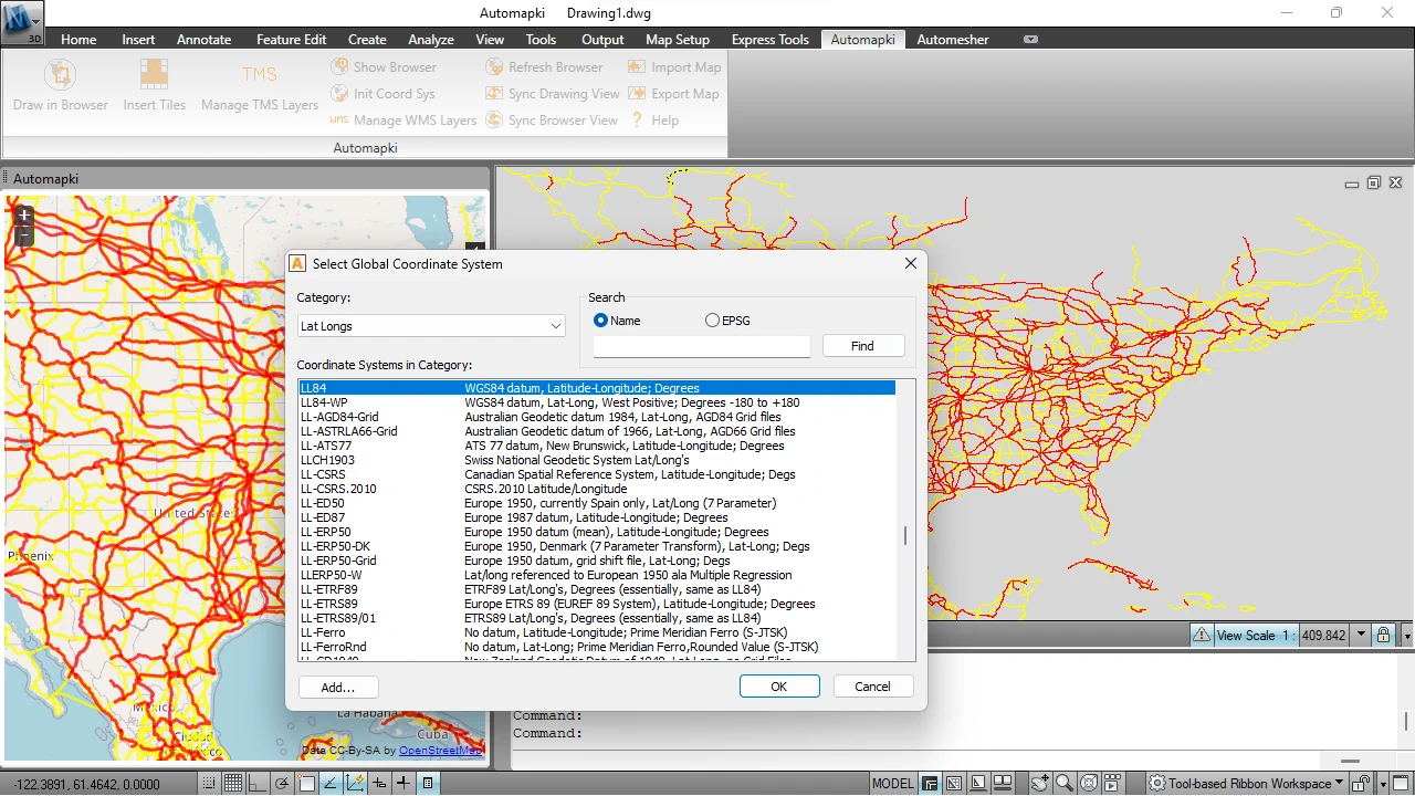
This is the most critical step for accurate georeferencing. Select the correct coordinate reference system (CRS) for your drawing from a library of over 3,000 options. Search by EPSG code or by country to find the right projection - for example, UTM zones, national grids, or local coordinate systems. Choosing the wrong CRS will misplace your drawing on the map.
🔍 Select DWG Entities to Export
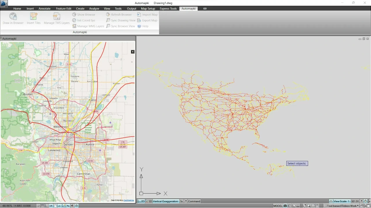
Choose which DWG drawing entities you want to include in the export - lines, polylines, polygons, or other geometry. You can select individual entities or export entire layers, giving you precise control over what appears in the final KML file.
💾 Export to KML Format
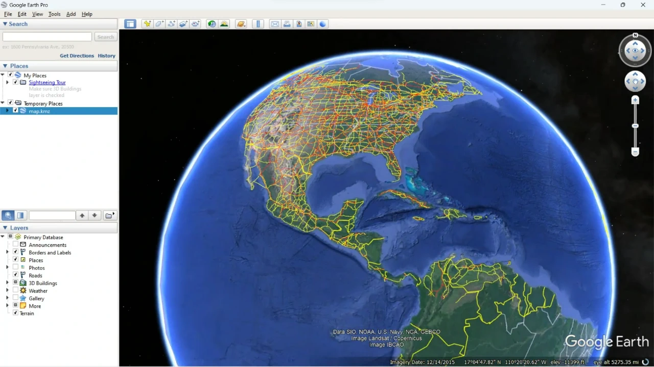
Click Save to generate the KML file. Automapki exports your selected DWG entities as styled KML line strings and polygons, preserving layer colors and structure so your drawing looks clean and readable inside Google Earth.
📦 Export to KMZ Format (Optional)
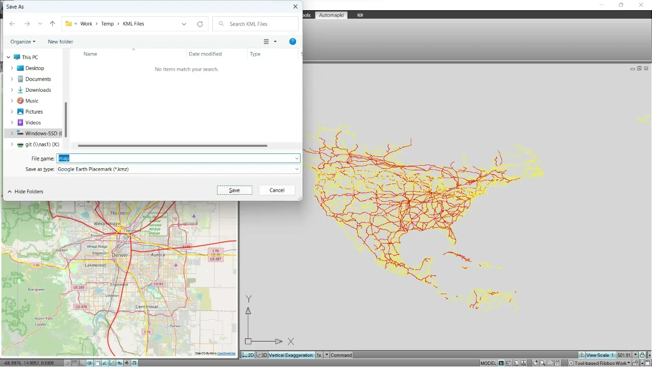
For easier sharing and smaller file sizes, export as KMZ - the compressed version of KML used natively by Google Earth. KMZ files bundle all assets into a single archive, making them ideal for sending to clients, collaborators, or embedding in presentations.
Frequently Asked Questions
-
Can I overlay an AutoCAD drawing on Google Earth?
Yes. With Automapki, you export your DWG or DXF drawing to KML or KMZ format, then open it in Google Earth. The result is your CAD geometry accurately placed over real-world satellite imagery, correctly positioned using the coordinate reference system you set during export.
-
What's the difference between KML and KMZ?
KML is an XML-based format that stores geographic features like points, lines, and polygons. KMZ is simply a compressed (zipped) KML file. Both open directly in Google Earth; KMZ is preferred for sharing because it's smaller and self-contained.
-
Which CAD applications does Automapki support for DWG to KML export?
Automapki works as an add-on inside AutoCAD, BricsCAD, GstarCAD, and ZWCAD. Any DWG file you can open in those platforms can be exported to KML or KMZ.
-
Does the coordinate system matter for Google Earth export?
Absolutely. Google Earth uses the WGS84 geographic coordinate system (EPSG:4326). Automapki handles the reprojection automatically - you just need to specify the source CRS of your DWG drawing so the conversion is accurate. An incorrect EPSG code will shift your geometry to the wrong location on the globe.
-
What DWG geometry is supported in the export?
Automapki exports lines, polylines, and polygons from your DWG as styled KML features. Layer colors are preserved as KML styles, so the visual structure of your drawing carries over into Google Earth.
Summary
With Automapki add-on, exporting AutoCAD drawings to KML or KMZ for Google Earth is a straightforward, six-step process - with full coordinate reference system control, entity-level selection, and automatic KML styling. No manual GIS work, no coordinate recalculation by hand.
Whether you're overlaying a site plan, cadastral boundary, infrastructure route, or urban design proposal onto Google Earth's satellite imagery, Automapki gives you a precise, reliable bridge from CAD to geospatial.
👉 Download Automapki add-on and start visualizing your AutoCAD drawings in Google Earth today.