Working with Google Earth data in AutoCAD requires converting geographic KML or KMZ files into editable DWG geometry - and that's not something AutoCAD handles natively. This guide walks you through importing KML and KMZ files directly into AutoCAD, BricsCAD, or ZWCAD using Automapki Application, a CAD plugin purpose-built for GIS and geospatial workflows.
What Are KML and KMZ Files?
KML (Keyhole Markup Language) is an XML-based format used by Google Earth and Google Maps to store geographic data - including points, lines, polygons, and placemarks. KMZ is simply a compressed (zipped) version of a KML file, often used when the dataset includes embedded images or overlays.
Both formats store coordinates in WGS84 (geographic latitude/longitude), which must be reprojected into a local coordinate reference system before the data can be used accurately in a CAD drawing.
How to Import KML/KMZ Files into AutoCAD: Step-by-Step
The process takes under five minutes and preserves full spatial accuracy via coordinate system transformation.
📥 Download and Install Automapki
Download the free trial of Automapki Application and install it on your machine. The plugin integrates directly into AutoCAD, BricsCAD, GstarCAD, and ZWCAD - adding a dedicated ribbon tab and command set for map import and export.
🚀 Run Map Import Command
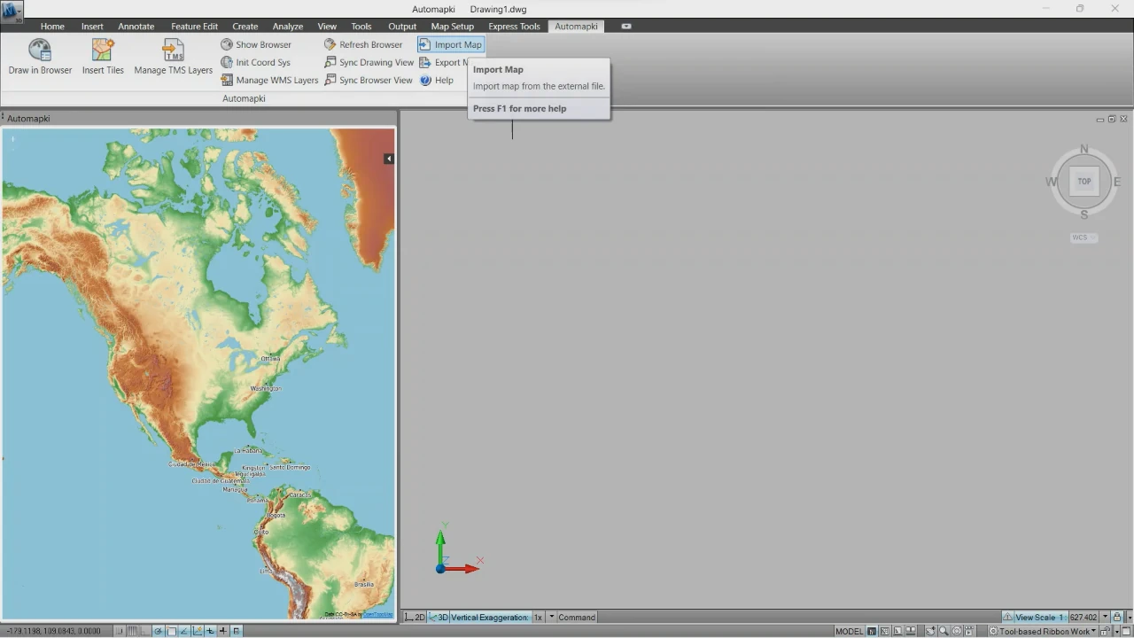
Open your CAD application and type AmImportMap in the command line, or click Import Map in the Automapki ribbon bar. This launches the import dialog.
🌎 Select Coordinate Reference System
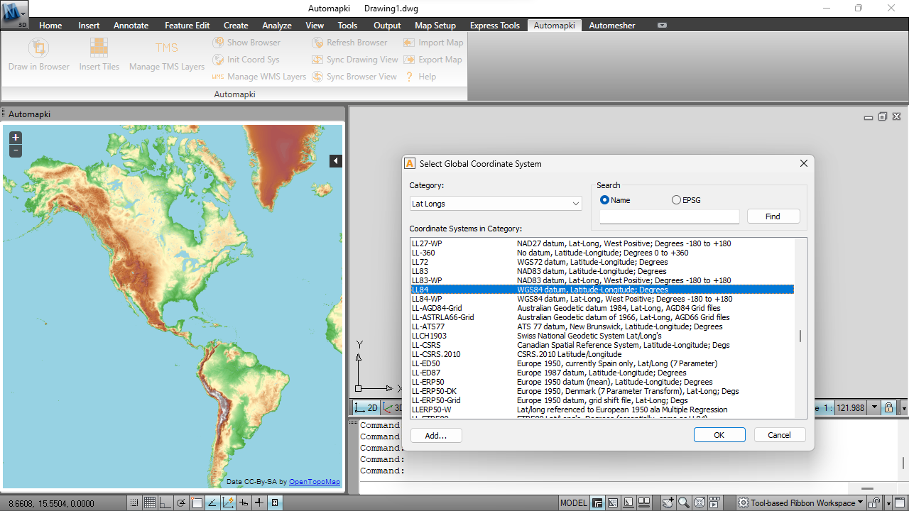
Choose the coordinate system that matches your project from a library of over 3,000 predefined reference systems. This step reprojects the KML data from geographic coordinates (WGS84) into your local CRS, ensuring the imported geometry aligns correctly with your existing DWG drawing.
If you're unsure which CRS to use, check with your local surveying authority or GIS provider - using the wrong projection will cause significant positional errors.
🔍 Select Your KML or KMZ File
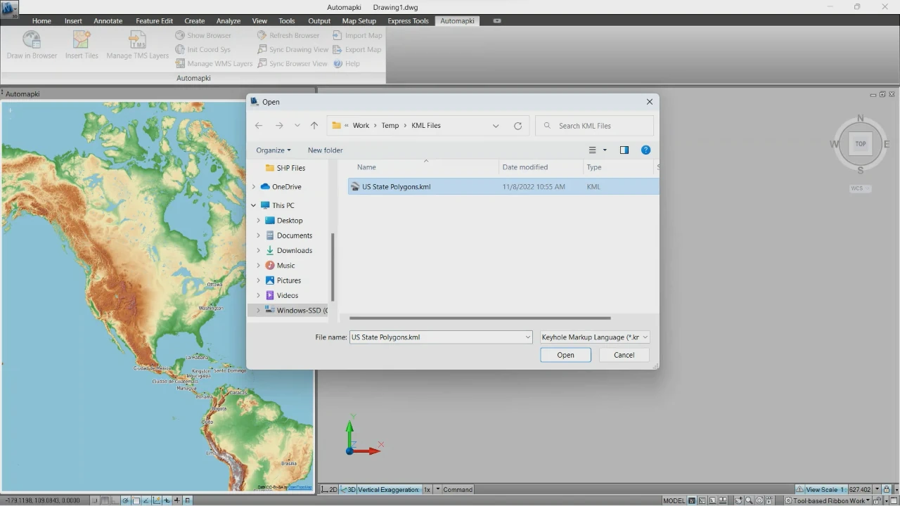
Browse to your KML or KMZ file and select it. Both formats are supported natively - there's no need to decompress KMZ files manually before importing.
📂 Import Placemarks into AutoCAD
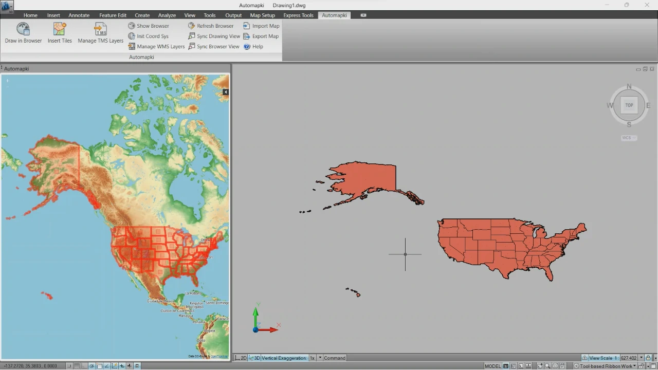
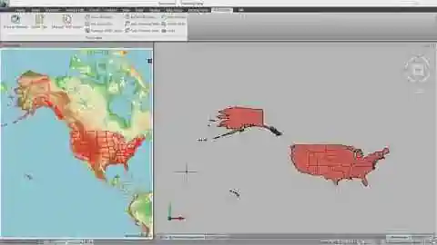
Click Open to complete the import. Automapki converts all placemark geometry - points, polylines, and polygons - into native AutoCAD entities placed accurately in model space. Attribute data from the KML file (names, descriptions) is also carried over where applicable.
Can I Edit KML/KMZ Data After Importing into AutoCAD?
Yes - once imported, all geometry becomes standard AutoCAD objects. You have full access to every editing tool in your CAD application:
- Move, Scale, and Rotate: Reposition or resize map elements using AutoCAD's standard transformation command.
- Edit Vertices: Modify polyline and polygon shapes by adjusting grips or using the PEDIT / SPLINEDIT commands.
- Assign Layers, Colors, and Line Types: Organize imported geodata into named layers for clear visual separation between roads, boundaries, contours, and other feature types.
- Annotate and Dimension: Add labels, dimensions, and callouts using AutoCAD's full annotation toolkit.
- Export to Other Formats: Once edited, export the DWG to PDF, SHP, or other formats for downstream use.
This makes Automapki particularly useful for urban planning, land surveying, environmental assessment, and infrastructure design - any discipline that starts with real-world geographic data and needs to work with it in a CAD environment.
Supported CAD Platforms
Automapki works as a plugin inside the following CAD applications:
- AutoCAD (all recent versions)
- BricsCAD
- ZWCAD
- GstarCAD
It is not a standalone converter - the plugin runs inside your existing CAD environment, so the imported geometry appears directly in your active drawing without any intermediate file steps.
Frequently Asked Questions
-
Does Automapki support KMZ files or only KML?
Both formats are supported. KMZ files are imported directly without requiring manual extraction - the plugin handles decompression automatically.
-
Will the imported geometry be georeferenced?
Yes. By selecting the correct coordinate reference system in Step 3, all imported geometry is transformed from WGS84 into your chosen local CRS, maintaining full spatial accuracy.
-
Can I import multiple KML files into the same drawing?
Yes. Run the AmImportMap command multiple times to import additional KML or KMZ files into the same DWG. Each import can use a different layer assignment to keep datasets organized.
-
Can I also export AutoCAD data back to KML or KMZ?
Yes. Automapki supports bidirectional conversion - you can export DWG geometry back to KML, KMZ, or ESRI SHP formats for use in Google Earth or GIS platforms.
-
Is there a free trial?
Yes. A free trial of Automapki is available for download with no time limit on evaluation.
Summary
Importing KML and KMZ files into AutoCAD is straightforward with the right plugin. Automapki handles coordinate reprojection, compressed KMZ files, and full geometry conversion in five steps - and the resulting DWG objects are fully editable with standard AutoCAD tools.
👉 If your work involves integrating Google Earth data into CAD drawings, it's the most direct path from geographic data to a production-ready DWG. Download the free trial of Automapki to get started.