Need to extract a KML file from a KMZ archive? The good news is you don't need any software - KMZ is simply a ZIP-compressed KML file, and Windows Explorer can open it natively. This guide covers the free Windows-only approach for one-off conversions.
What Is the Difference Between KMZ and KML?
KML (Keyhole Markup Language) is an XML-based text format for storing geographic data - placemarks, polygons, lines, and overlays - used by Google Earth, Google Maps, and most GIS platforms. It is human-readable and easy to edit in any text or XML editor.
KMZ is simply a KML file that has been compressed using ZIP compression and renamed with the .kmz extension. A KMZ file may contain a single doc.kml file, or it may also bundle linked images, overlays, and other resource files in subfolders alongside the KML.
Because KMZ is a standard ZIP archive under a different extension, you can extract its contents using Windows Explorer without any additional tools.
How to Convert KMZ to KML Free Using Windows Explorer: Step-by-Step
-
🔍 Locate Your KMZ File

Open Windows Explorer and find your .kmz file - typically in your Downloads or Documents folder. If file extensions are not visible, enable them first with the "Hide extensions for known file types" setting.
-
✏️ Rename KMZ File to ZIP
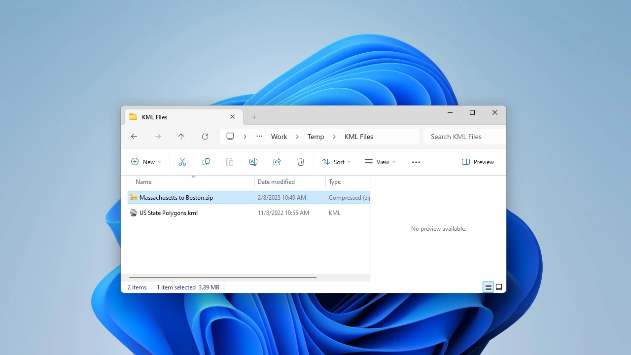
Right-click the .kmz file and select Rename. Change the file extension from .kmz to .zip and press Enter. Windows will ask you to confirm the extension change - click Yes. The file icon will change to a standard ZIP archive icon.
-
⏏️ Extract ZIP to Get KML File
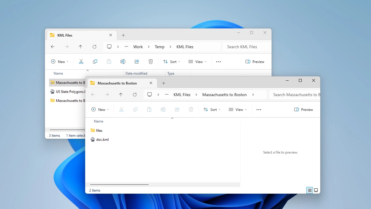
Right-click the renamed .zip file and select Extract All. Choose an output folder and click Extract. Inside the extracted folder you will find a doc.kml file - this is your KML data. Rename it to something descriptive if needed.
If the KMZ also contained overlay images or linked resources, they will appear in subfolders alongside the KML file. Keep them together if the KML references those files.
What's Inside a KMZ File?
Understanding the KMZ structure helps when working with more complex files. A typical KMZ archive contains a primary doc.kml file at the root, and optionally a files/ subfolder containing overlay images (PNG, JPEG), ground overlays, screen overlays, and model files. When you extract the KMZ, all of these become accessible directly.
Simple KMZ files from Google Earth exports contain only the doc.kml. More complex KMZ files from GIS platforms or mapping services may include dozens of linked resources - make sure to keep the folder structure intact when using the extracted KML in another application.
Frequently Asked Questions
-
Can I convert KMZ to KML on Mac?
Yes. The same rename-and-extract approach works on Mac: change the .kmz extension to .zip, then double-click to extract using the built-in Archive Utility. The doc.kml file will appear in the extracted folder.
-
Why does my extracted KML show "doc.kml" as the filename?
That is the standard default filename for the primary KML document inside a KMZ archive. Rename it to anything descriptive after extraction - the KML content and data are not affected by the filename.
-
Can I convert KML back to KMZ?
Yes. Select your KML file (and any linked resource files) in Windows Explorer, right-click and choose Compress to ZIP file, then rename the resulting .zip to .kmz. The file will open correctly in Google Earth and other KMZ-compatible tools.
-
Does the KMZ to KML conversion lose any data?
No. KMZ is just a compressed container for KML - extracting it gives you the identical KML data. No geographic information, placemarks, or styling is lost in the process.
-
Can I import KMZ files directly into AutoCAD?
Not natively, but Automapki Application imports KMZ files directly into AutoCAD, BricsCAD, and ZWCAD without requiring manual extraction. It converts the geographic data to DWG geometry with coordinate system transformation.
Summary
Converting KMZ to KML requires no software - rename the file from .kmz to .zip and extract it using Windows Explorer. The KML file inside is your converted data, ready for use in Google Earth, GIS platforms, web maps, or CAD workflows. For batch conversion or direct import into AutoCAD and other CAD tools, Automapki Application handles KMZ files natively without the manual extraction step.