
KML and KMZ files from Google Earth, GIS platforms, or surveying software frequently need to enter AutoCAD workflows - and AutoCAD DWG drawings often need to go the other way, exported to KML or KMZ for display in Google Earth or shared with GIS users. This guide covers both directions using two different approaches: AutoCAD's built-in MAPIMPORT / MAPEXPORT commands and Automapki Application plugin for standard AutoCAD and non-Autodesk DWG editors.
What Are KML and KMZ Files?
KML (Keyhole Markup Language) is an XML-based geographic data format originally developed for Google Earth. It stores placemarks, polygons, polylines, points, and raster overlay images with WGS84 geographic coordinates - the standard coordinate system used by GPS and most web mapping platforms.
KMZ is simply a ZIP-compressed KML file that bundles the KML document with any referenced image overlays or assets in a single portable file. KMZ is the preferred sharing format since it's smaller and self-contained.
Both formats are widely used in civil engineering, urban planning, environmental assessment, surveying, and any workflow that needs to connect CAD drawings with real-world geographic coordinates.
Method 1: Using MAPIMPORT and MAPEXPORT
AutoCAD Map 3D and Civil 3D include the MAPIMPORT command, which handles KML and KMZ files natively alongside other GIS formats (SHP, GeoJSON, etc.).
How to Import KML Using MAPIMPORT
- Open AutoCAD Map 3D or Civil 3D and start a new drawing or open your target DWG project.
- Type MAPIMPORT in the command line and press Enter.
- Select your KML or KMZ file from the file browser.
- Assign a coordinate system - specify the projection that matches your KML data (typically WGS84 / EPSG:4326 for standard Google Earth KML) and the target coordinate system for your DWG drawing. Correct CRS assignment is essential - without it, the imported geometry lands in the wrong location relative to your drawing.
- Click OK. The KML geometry imports as AutoCAD points, polylines, and polygons in the DWG model space.
How to Export DWG to KML Using MAPEXPORT
- Select the DWG features you want to export to KML.
- Type MAPEXPORT in the command line.
- Choose KML or KMZ as the output format and specify the output file location.
- AutoCAD reprojects the selected DWG entities from the drawing's coordinate system to WGS84 and writes the KML file.
The exported KML file opens in Google Earth, Google Maps, QGIS, or any KML-compatible mapping platform.
Method 2: Using Automapki Application
Standard AutoCAD (without Map 3D) does not include MAPIMPORT or MAPEXPORT. Automapki adds KML and KMZ import/export to standard AutoCAD, and also works in BricsCAD, ZWCAD, and GstarCAD - DWG editors that have no built-in GIS capability.
How to Import KML Using Automapki
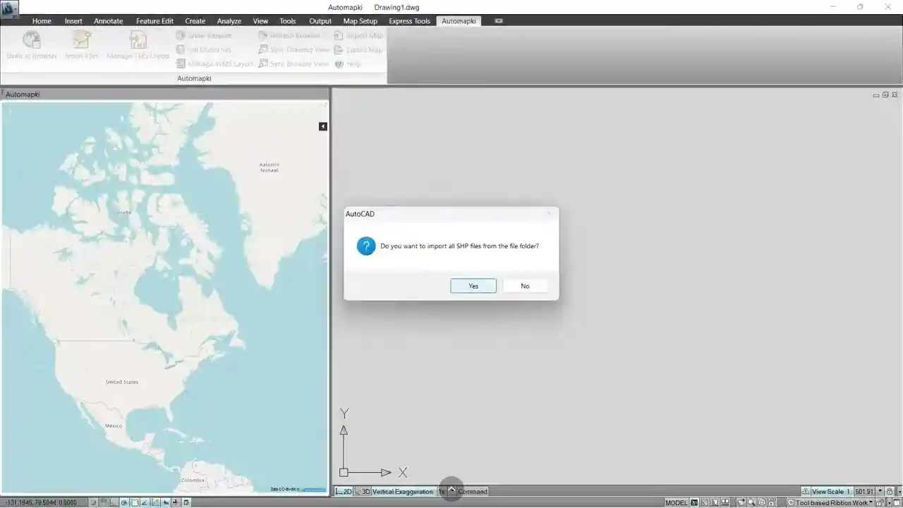
- Install Automapki Application and restart your CAD software.
- Run the AmSetCoordSys command to assign the coordinate reference system for your DWG drawing - Automapki reprojects the KML data from WGS84 into your drawing's local coordinate space.
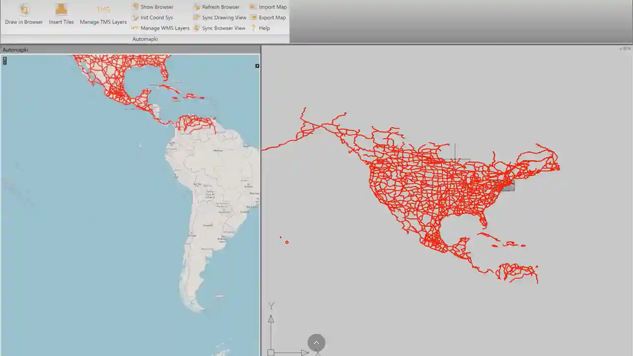
- Run the AmImportMap command, select your KML or KMZ file, and click Open. The geometry imports into the DWG model space as georeferenced CAD entities.
How to Export DWG to KML/KMZ Using Automapki
- Run the AmExportMap command or click Export Map in the Automapki ribbon.
- Select the DWG entities to export.
- Choose KML or KMZ as the output format and specify the output file path. Automapki reprojects the geometry from your DWG coordinate system back to WGS84 for the KML output.
KMZ output is recommended for sharing - it bundles everything in a single compressed file and is typically 60–80% smaller than the equivalent KML.
KML Ground Overlay Images in AutoCAD
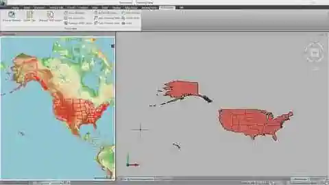
KML files can contain ground overlay images - georeferenced raster images (aerial photos, satellite imagery, scanned maps) anchored to specific geographic coordinates. Automapki imports these ground overlays as raster image objects in the DWG, positioned and scaled to match their geographic extent in the drawing's coordinate system. This is particularly useful for importing georeferenced imagery from Google Earth Pro or other mapping tools as a drawing background.
MAPIMPORT/MAPEXPORT vs Automapki: Feature Comparison
| Feature | MAPIMPORT / MAPEXPORT | Automapki Plug-in |
|---|---|---|
| Supported Software |
|
|
| Import KML/KMZ | ✅ Yes | ✅ Yes |
| Export KML/KMZ | ✅ Yes | ✅ Yes |
| Batch Import/Export | ❌ No | ✅ Yes |
| Coordinate System Conversion | ✅ Yes | ✅ Yes (3,000+ CRS) |
| Map Overlays | ⚠️ Limited | ✅ Yes |
| Maps Browser | ❌ No | ✅ Yes |
Common KML/KMZ and AutoCAD Use Cases
- Import site boundaries from Google Earth into AutoCAD - draw a site boundary or property polygon in Google Earth, export as KMZ, then import into AutoCAD as a georeferenced polyline for civil design work
- Export AutoCAD site plan to Google Earth - convert a site layout DWG to KMZ for presentation to clients or planning authorities in Google Earth
- Import GIS data into BricsCAD or ZWCAD - bring KML features from municipal GIS systems into BricsCAD or ZWCAD drawings using Automapki when MAPIMPORT is not available
- Overlay georeferenced aerial imagery - import KML ground overlay images as drawing backgrounds in AutoCAD for site context and design verification
- Round-trip GIS/CAD workflows - import KML boundary data, perform CAD design work, then export back to KMZ for GIS review - all without leaving the CAD environment
KMZ Files with Embedded 3D Models (Collada DAE)
KML supports a <Model> element that attaches a 3D geometry model to a geographic position - this is how 3D buildings and structures appear in Google Earth. The geometry is stored as a Collada DAE file referenced or embedded within the KMZ package. A KMZ file containing a 3D model is effectively a ZIP archive with two components:
- A .kml file defining the geographic position (longitude, latitude, altitude) and orientation of the model using the
<Model>element - A .dae file (Collada DAE) containing the 3D mesh geometry of the building or object, along with any texture images
This combination enables precise georeferenced 3D visualization - a building model placed at its exact coordinates on the Earth's surface, visible in Google Earth and any KML-compatible viewer.
Converting 3D Models to KMZ for Google Earth
To place a 3D building or structure model in Google Earth via KMZ, the workflow is:
- Create or export the 3D model as a DAE (Collada) file from SketchUp, AutoCAD, or other modeling tools
- Create a KML file with a
<Model>element specifying the geographic coordinates (WGS84 longitude/latitude/altitude) and orientation (heading, tilt, roll) - Package the KML and DAE files (plus any textures) into a ZIP archive and rename to .kmz
Automapki Application simplifies this workflow with the AmExportMap command - DWG 3D geometry exports to KMZ with the embedded DAE model georeferenced to the correct WGS84 coordinates based on the drawing's assigned CRS.
Frequently Asked Questions
Can standard AutoCAD (without Map 3D) import KML files?
Not natively. Standard AutoCAD doesn't include MAPIMPORT or any KML support. Automapki Application adds KML and KMZ import and export to standard AutoCAD, as well as BricsCAD, ZWCAD, and GstarCAD.
Why does imported KML geometry appear in the wrong location in my drawing?
This is a coordinate system mismatch. KML files use WGS84 geographic coordinates (longitude/latitude). If your DWG drawing uses a local projected coordinate system (UTM, state plane, national grid), you must assign the correct target CRS using AmSetCoordSys (Automapki) or specify the correct coordinate system in MAPIMPORT before importing. An incorrect or missing CRS assignment places the geometry at the wrong coordinates.
What is the difference between KML and KMZ?
KML is a plain-text XML file containing geographic data. KMZ is a ZIP archive containing a KML file plus any referenced assets (overlay images, icons). For sharing, KMZ is preferred - it's self-contained and typically 60–80% smaller than the equivalent uncompressed KML.
Is there a free trial of Automapki Application?
Yes. Automapki Application is available as a free evaluation download with no time limit on the trial period.
Summary
Importing KML into AutoCAD and exporting DWG to KML/KMZ requires either AutoCAD Map 3D's built-in MAPIMPORT / MAPEXPORT commands, or Automapki Application for standard AutoCAD, BricsCAD, ZWCAD, and GstarCAD. Both approaches handle coordinate system reprojection - assigning the correct CRS is the most important step in either workflow. Automapki additionally supports WMS/TMS tile overlays, KML ground images, batch processing, and a built-in map browser.
👉 Ready to get started? Download Automapki Application and try it free.